Here you will learn how contours on a map represent various relief forms and details. You will also learn what a contour step is.
Relief forms
Contour lines on the map are called horizontals. They show where the terrain rises and falls, and whether it is steep or flat. By learning to read the contour lines, you will be able to see terrain features such as mountains and valleys, hills, depressions, ridges, and knolls. Press the buttons to see various terrain forms.
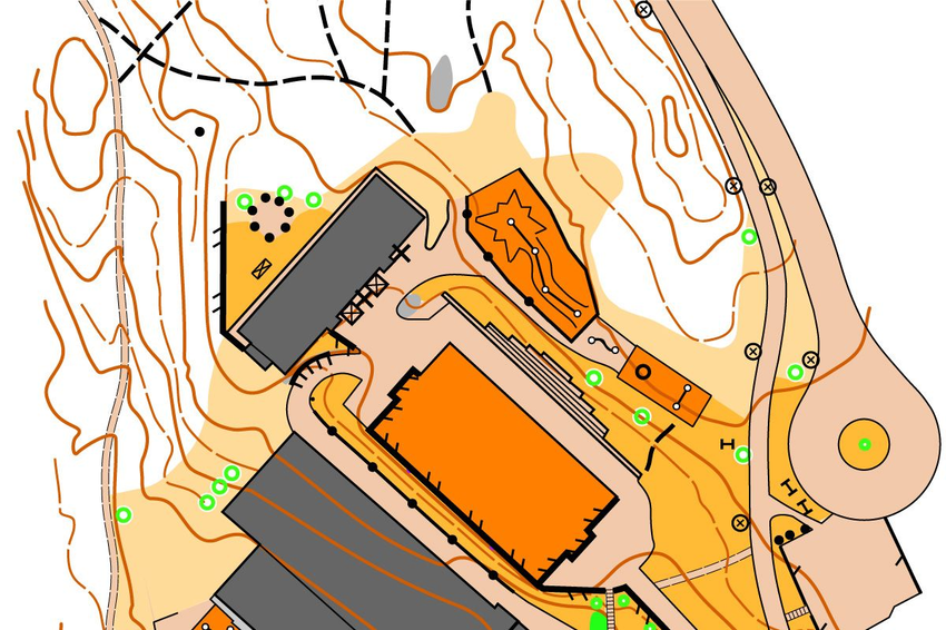
Microwave
A mountain can be a good landmark - you usually get a better view of the area if you climb these small peaks.
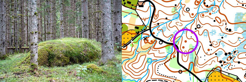
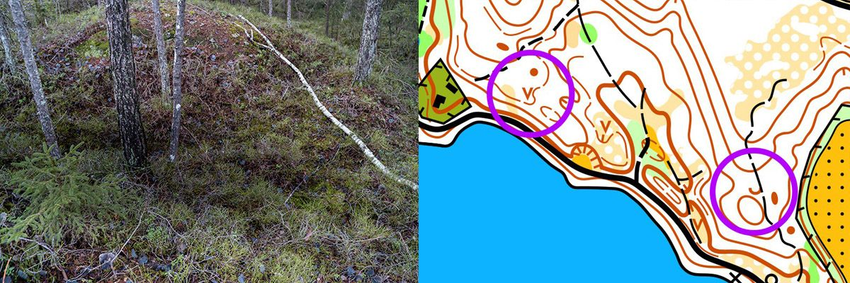
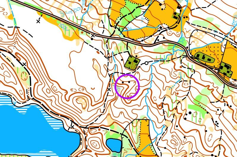
"The keystone nose can be a great linear landmark."
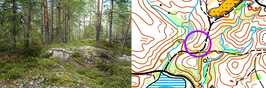
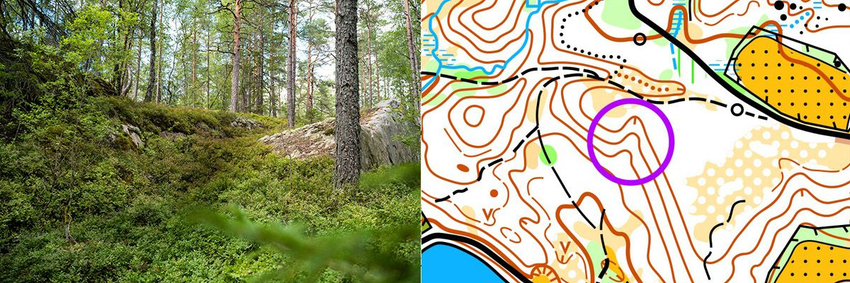
A long edge can also be a linear landmark.
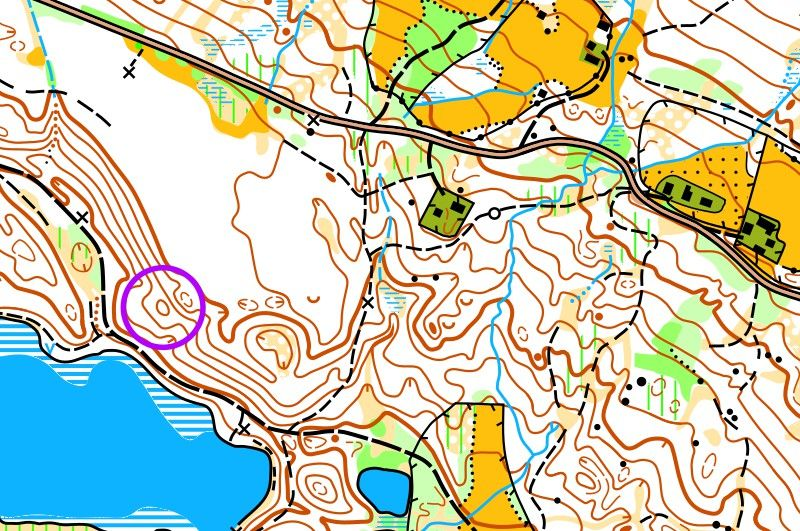
A microdepression is a small hollow or indentation in the terrain.
Practice reading horizontals
Hills can be helpful - usually once you climb these small peaks, you can better view the area. Reading contours might seem somewhat challenging for beginners, but once learned, it becomes very interesting. Press the buttons to see how contours reflect different landforms.
Near Horizons
Medium distance contours
Distant Horizons
Closed Horizons
Role
Flow of water example
TIP
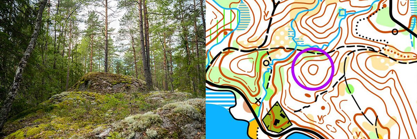
A nose or a limestone can be great landmarks, similar to linear landmarks.
Horizontal Ladder
Each contour line is drawn across locations that are at the same height above sea level. There is a fixed vertical height difference between two contour lines, known as the contour interval. Typically, this is 5 meters. This means that there is a 5-meter height difference between two adjacent contour lines. Every fifth contour line is often marked with a thicker line. This is done to enhance the visual representation of the terrain and facilitate understanding the height difference between different points.
Flat, sloping terrain
Sometimes the horizon is 2.5 meters. In such cases, the terrain is usually quite flat, sloping, or even.
Move the slider. In flat terrain areas, the formations on the map are easier to see when the contour interval is 2.5 meters and contours were added for clearer visibility of elevation shapes. On maps with few contours, the contour interval is 5 meters.
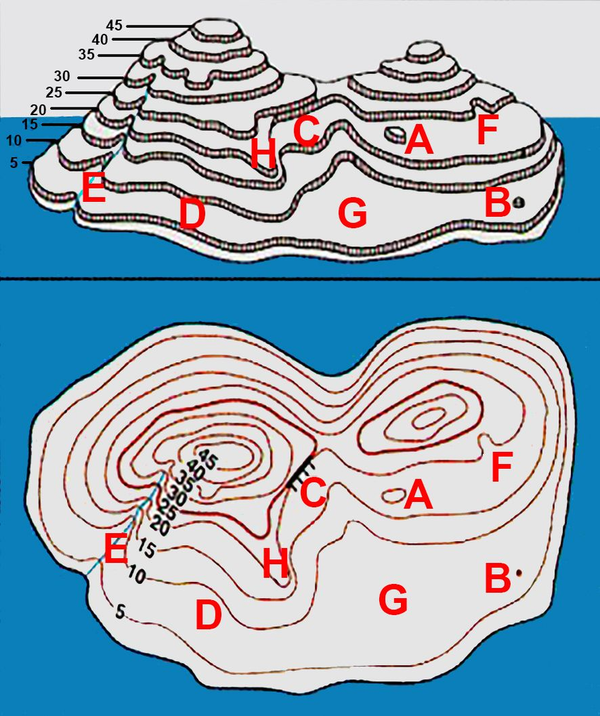
Have a look at this simplified island draft and the map below.
Imagine that the water level rises by 5 meters, then the edge of the water reaches the first horizontal line. Each time the water level rises by 5 meters, it reaches a new horizontal line. If the water level rises by 20 meters, we will have two smaller islands. On the west side of the islands, there are numbers on each horizontal line. These are the heights of each horizontal line above sea level. Thus, the peak on the left is 45 meters above sea level.
Location formation illustration
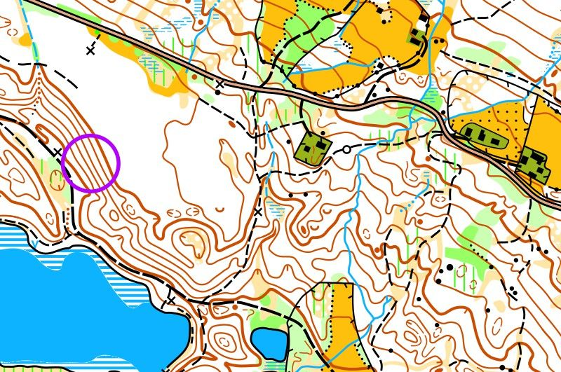
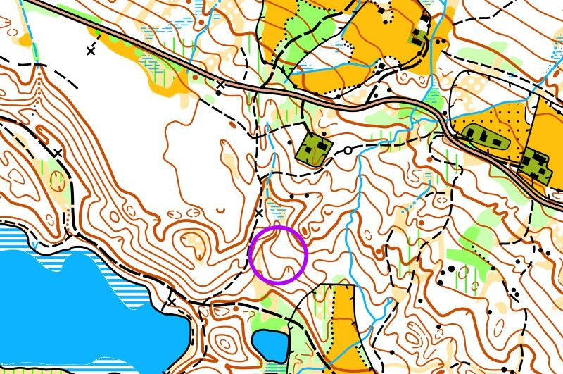
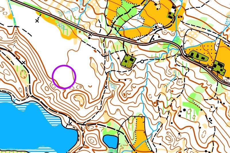
A. is a 5 m high mound. B. is a micro mound. C. is a steep slope with a rock. D. is a flat, sloping slope. E. is a long depression, a hollow with a stream. F. is a small depression, a hollow. G. is a shallow, sloping area. H. is a nose.
Simple Orientation by Horizontals
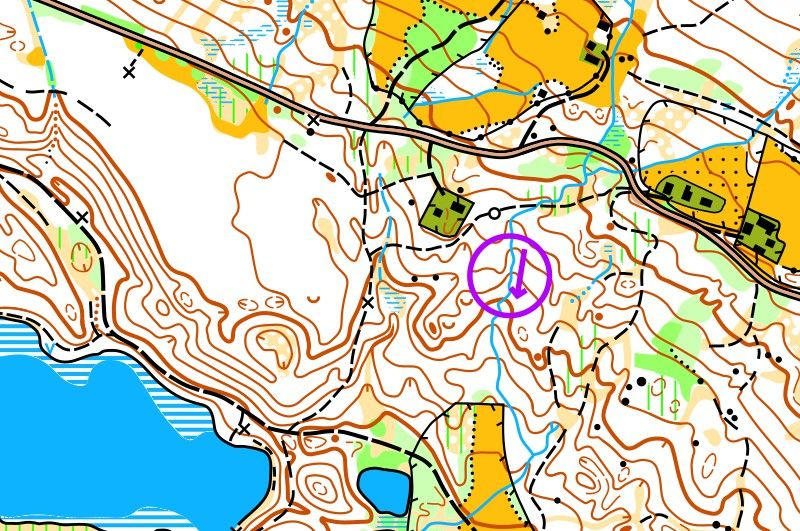
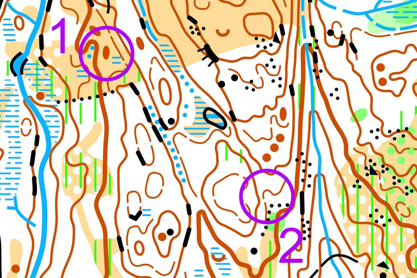
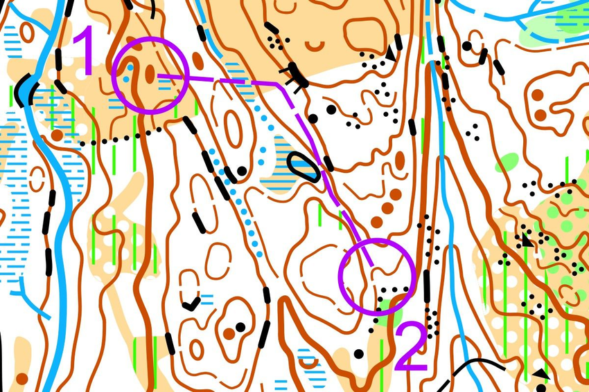
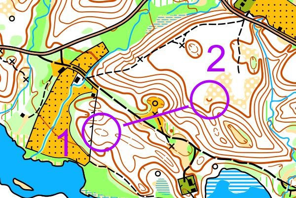
You are standing at CP 1, on a small hill. The next CP is at the bottom of the valley. Slide the slider to see how to use the contours to find the path:
Using a compass, head towards the rock. Along the way, on the left, you'll see a small hill, and on the right - a larger one. Head along the hill southeast until you reach a slope on the left and a swamp on the right. Continue in the same direction. On the left, you'll still see the larger hill, and on the right - a slightly smaller, more sloping hill. Go between the hills and down to KP in the hollow, in the depression.
Question 1 of 8
What do the horizontals show?
What is a Horizontal Ladder?
When the contours are close together, the terrain is:
When the contours are far apart, the terrain is:
If you move in a horizontal direction, you ...
Which of these landforms is depicted using contours?
How does the terrain change from checkpoint 1 to 2?
How does the terrain change from checkpoint 1 to 2?